
Mount Elgon Sasa Trail vs Sipi Trail vs Piswa: Which route is best?
Mount Elgon offers several trekking routes to Wagagai Peak, Uganda’s highest point at 4,321 metres above sea level. The Sasa, Sipi and Piswa trails approach the mountain from different directions, each providing a distinct experience. Some hikers want the shortest possible route to the summit, while others prefer a gradual ascent, forest walks, waterfalls, caves and wide views across the mountain’s highland landscapes.
Choosing between these three routes depends on your fitness, available time, preferred scenery and tolerance for steep climbs. The Sasa Trail is the shortest and most direct approach, but it has a demanding first day. The Sipi Trail provides a longer journey through varied landscapes and works particularly well for visitors who want to explore the Sipi Falls area. The Piswa Trail is generally the gentlest ascent and offers a quieter approach from the northern side of Mount Elgon.
All three routes can lead to Wagagai Peak, although the number of days required depends on the itinerary, campsite arrangements, walking pace and whether you return by the same trail or descend along a different route.
Understanding Mount Elgon and its trekking routes
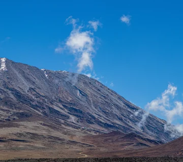
Mount Elgon is an extinct volcano situated on the Uganda-Kenya border. Its broad mountain slopes rise above eastern Uganda, with the highest point, Wagagai Peak, reaching 4,321 metres. The mountain has a large summit caldera surrounded by ridges, rocky peaks and extensive high-altitude moorland.
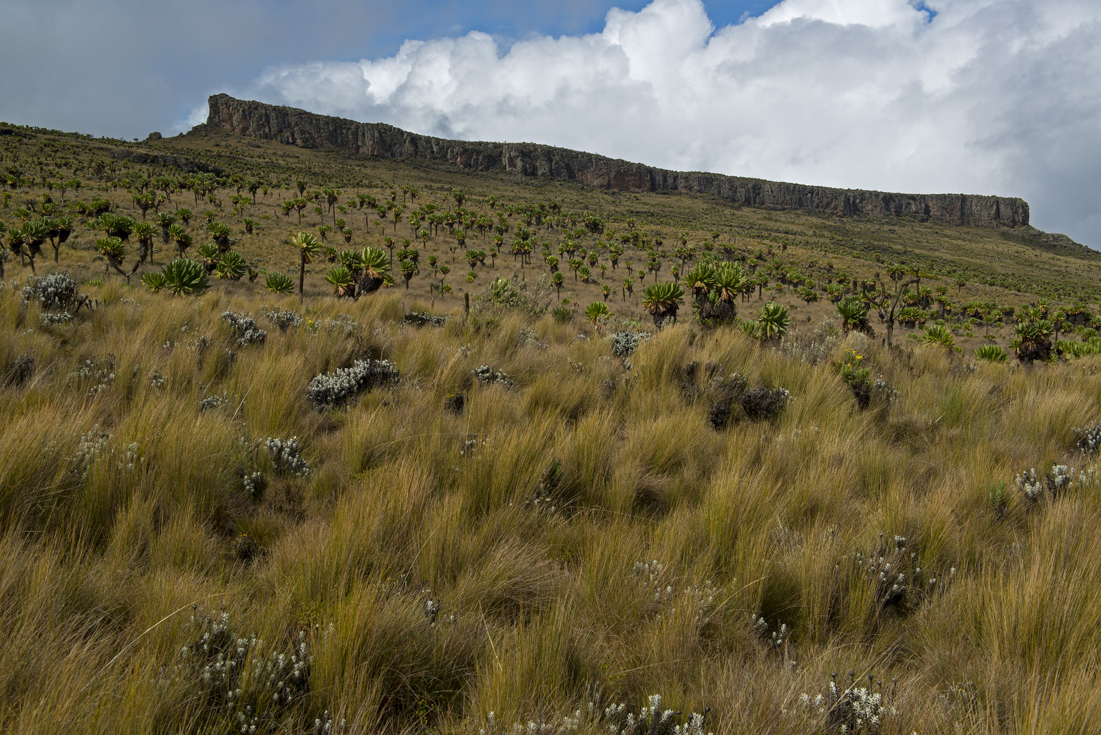
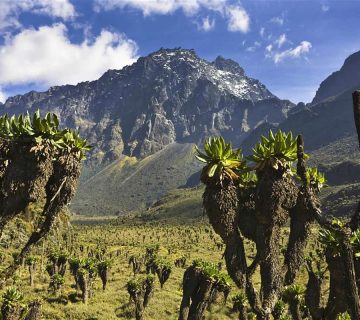
Unlike a narrow mountain with one obvious climbing path, Mount Elgon has several approaches. The lower slopes contain farmland, forest and bamboo vegetation. Higher up, the landscape changes into open heath, giant heathers, rocky ground and alpine vegetation. Streams, waterfalls, caves and unusual mountain plants add variety to the trekking experience.
The three main Ugandan routes differ considerably in their starting elevations. Sasa begins around Budadiri at approximately 1,250 metres, while Sipi starts near Kapkwai at about 2,050 metres. Piswa approaches from Kapkwata on the northern side.
These differences affect the difficulty of each trek. A route that starts lower may require a much greater elevation gain, even when its total distance is shorter. A longer route can distribute the climb over several days, giving hikers more time to adjust to the changing altitude.
Mount Elgon is not a technical mountain climb. You do not normally need ropes, crampons or specialist mountaineering skills to reach Wagagai. However, the trek requires good physical fitness, suitable equipment and the ability to walk for several consecutive days in changing weather.
Sasa Trail: The shortest and steepest route
The Sasa Trail is the most direct traditional route to Wagagai Peak. It begins near Budadiri in the Sironko Valley, on the eastern side of Mount Elgon. Its lower starting elevation makes the first day particularly demanding.
The trail starts at approximately 1,250 metres and climbs towards the higher forest and mountain zones. Hikers can gain around 1,600 metres in elevation during the initial ascent, depending on the exact itinerary and campsite arrangements. This rapid climb makes Sasa the toughest of the three routes during its opening section.
One of the most challenging sections involves the Mudange Cliffs, where the trail climbs steeply through rugged terrain. This section requires steady movement, secure footing and enough energy to continue after a demanding morning.
The route passes through different vegetation zones as it gains height. Lower sections include farmland and forest, followed by bamboo vegetation and higher mountain habitats. The changing scenery gives hikers a clear understanding of how Mount Elgon’s environment changes with altitude.
Sasa also provides access to features such as Jackson’s Pool and Jackson’s Peak, depending on the itinerary. These locations add interest to the upper mountain experience and provide opportunities to explore beyond the direct summit approach.
How long does the Sasa Trail take?
A typical Sasa summit trek takes three to four days. A shorter itinerary may be possible for strong hikers, but four days generally provide a more comfortable schedule for walking, camping and returning safely.
The exact duration depends on whether you climb and descend through Sasa or combine it with another route. A traverse that descends through Sipi requires different transport arrangements and additional planning.
Who should choose Sasa?
Sasa is suitable for hikers who have limited time and want the most direct approach to Wagagai. It also suits people who enjoy steep mountain trails and have experience with long uphill walks.
However, you should not select Sasa simply because it takes fewer days. The steep first ascent can be difficult for beginners, particularly those who have not trained on hills or carried a daypack over long distances.
If you are reasonably fit, comfortable with steep terrain and have only three or four days available, Sasa can be an effective option. If you prefer a more gradual introduction to high-altitude trekking, consider Sipi or Piswa.
Sipi Trail: The scenic route with varied landscapes
The Sipi Trail starts near the Kapkwai Forest Exploration Centre, above Sipi Falls in Kapchorwa District. Its starting elevation is approximately 2,050 metres, making it considerably higher than the Budadiri starting point used by Sasa.
The higher starting elevation and longer approach allow hikers to spread the climb over more walking days. The trail passes through forest, mountain vegetation, rocky sections and open moorland before reaching the upper caldera and Wagagai summit area.
Sipi is particularly attractive to visitors who want a varied mountain experience. The surrounding area is already known for its waterfalls, coffee-growing communities, forest trails and viewpoints overlooking the plains below.
The trekking route provides opportunities to experience the mountain’s natural features at a relatively gradual pace. Tutum Cave is one of the notable attractions associated with the route. Depending on the itinerary, hikers may also explore other mountain features and enjoy views across the surrounding valleys.
The landscape changes as you climb. Forest sections give way to more open vegetation, while higher elevations offer broad views of Mount Elgon’s ridges and moorland. The route is especially rewarding for travellers interested in photography, natural scenery and birdwatching.
Sipi also works well for visitors who want to spend time around the waterfalls before or after the main mountain trek. The three well-known Sipi waterfalls are located on the lower slopes, and guided walks around them can be arranged separately from the summit expedition.
How long does the Sipi Trail take?
A typical Sipi summit itinerary takes approximately four to six days, although some organised programmes allow additional time for exploring the mountain. The route is longer than the direct Sasa approach, and the exact distance depends on the chosen camps and trail arrangement.
Some descriptions give the Sipi route a round-trip distance of approximately 56 kilometres. Treat this as a planning estimate because the actual distance changes with the itinerary and any additional excursions.
Who should choose Sipi?
Sipi is a strong choice for travellers who want a balance between mountain trekking and scenery. It suits hikers who have enough time for a multi-day expedition and prefer to avoid the severe elevation gain associated with the opening day of Sasa.
It is also a practical option for visitors combining Mount Elgon with a wider eastern Uganda trip. You can spend time around Sipi Falls, visit local coffee farms and explore Kapchorwa before or after climbing the mountain.
For many first-time Mount Elgon trekkers, Sipi provides a good balance of physical challenge, scenery and time on the mountain.
Piswa Trail: The gentlest approach and quieter northern side
The Piswa Trail approaches Mount Elgon from Kapkwata on the northern side of the mountain. It is generally regarded as the gentlest of the three main routes because it spreads the elevation gain over a longer distance.
Unlike Sasa, which climbs steeply from the lower slopes, Piswa offers a more gradual approach towards the upper mountain. This makes it attractive to hikers who prefer steady progress rather than a demanding first day.
The route passes through plantation areas, forest and open mountain vegetation before reaching the higher moorland. As you climb, the scenery opens towards the Karamoja plains in Uganda and the hills on the Kenyan side of Mount Elgon.
Piswa is also known for its quieter atmosphere. It generally receives less attention than the better-known Sasa and Sipi approaches, making it appealing to hikers who want a more remote trekking experience.
Wildlife and birdlife can add interest to the journey. The lower forest sections provide opportunities to observe mountain forest birds, while the upper slopes contain vegetation adapted to cooler conditions. Sightings of larger wildlife are possible in suitable habitats, but they should never be treated as guaranteed.
The route also provides access to the mountain’s hot springs, depending on the itinerary and conditions. These features are among the attractions that make a longer Mount Elgon expedition worthwhile.
How long does the Piswa Trail take?
Piswa commonly takes around five to seven days for a full summit itinerary, although shorter or longer arrangements may be possible. Some published route descriptions give a distance of approximately 49 kilometres for the round trip.
The longer schedule gives hikers more time to cover the distance and adjust to the altitude. However, the route still requires endurance because you will walk for several consecutive days, often over uneven ground.
Who should choose Piswa?
Piswa is a good choice for hikers who value a gradual ascent, quieter trails and broad mountain views. It is particularly suitable for people who have enough time and do not want to rush their climb.
It can also suit first-time high-altitude trekkers who are reasonably fit but prefer a less aggressive elevation profile. A gradual ascent may make the journey more comfortable, although it does not eliminate the possibility of altitude sickness.
Choose Piswa if you want to spend more time exploring Mount Elgon’s northern slopes and are comfortable with a longer expedition.
Comparing Sasa, Sipi and Piswa
The main differences become clearer when you compare their starting points, duration, difficulty and overall trekking experience.
Sasa Trail
Starting point: Budadiri, Sironko District.
Starting elevation: Approximately 1,250 metres.
Typical duration: Three to four days.
Main advantage: The shortest and most direct approach to Wagagai.
Main challenge: A steep initial ascent with substantial elevation gain.
Best suited to: Fit hikers with limited time who are comfortable with demanding uphill sections.
Sipi Trail
Starting point: Kapkwai Forest Exploration Centre, near Sipi Falls.
Starting elevation: Approximately 2,050 metres.
Typical duration: Four to six days.
Main advantage: Varied scenery, a higher starting point and access to the Sipi Falls area.
Main challenge: A longer trekking itinerary that requires several days of walking.
Best suited to: Travellers who want a scenic mountain experience with time for additional activities.
Piswa Trail
Starting point: Kapkwata, northern Mount Elgon.
Starting elevation: Varies according to the exact trailhead and itinerary.
Typical duration: Five to seven days.
Main advantage: A generally gradual ascent, quieter northern slopes and wide views.
Main challenge: A longer expedition requiring good endurance.
Best suited to: Hikers who prefer a slower climb and more time in the mountain environment.
These durations are general planning ranges rather than fixed schedules. Uganda Wildlife Authority arrangements, campsite availability, weather and the condition of your group can affect the final itinerary.
Which route is the easiest?
Piswa is generally the easiest of the three in terms of its gradual ascent. It avoids the rapid elevation gain associated with the opening day of Sasa and allows hikers to gain height more steadily.
Sipi is also a good option for people who prefer a less abrupt climb. Its higher starting point means that hikers begin the expedition closer to the mountain’s upper slopes than those using Sasa.
Sasa is the most physically demanding at the beginning. The climb from Budadiri involves a substantial elevation gain, and hikers must be prepared for steep sections early in the expedition.
However, the easiest route depends on your personal strengths. Someone who regularly walks steep hills may find Sasa manageable, while a person who struggles with long distances may find the extended Piswa itinerary tiring.
You should consider both elevation gain and total walking time when selecting a trail. A gradual route can still be demanding when you repeat long walking days.
Which route offers the best scenery?
All three routes provide attractive scenery, but they offer different experiences.
Sasa is particularly interesting because of its rapid transition from lower farmland and forest into bamboo and high-altitude vegetation. The steep climb gives you changing views as you gain elevation, and the route passes through distinctive mountain terrain.
Sipi offers a broad variety of scenery. The surrounding area includes waterfalls, cultivated slopes, forest, caves and open mountain landscapes. It is a particularly good option if you want to combine a summit trek with time exploring the lower slopes.
Piswa provides wide views across the northern side of Mount Elgon. Its open sections offer impressive panoramas towards the Karamoja plains and neighbouring Kenyan highlands. The quieter atmosphere is another attraction.
For the greatest variety of activities outside the summit climb, Sipi is a strong choice. For broad views and a quieter mountain approach, Piswa is particularly appealing. For dramatic changes in vegetation and a direct climb, Sasa has its own advantages.
Which route is best for wildlife and birdwatching?
Mount Elgon National Park protects several habitats, including montane forest, bamboo vegetation, heathland and high-altitude moorland. These environments support different bird and wildlife communities.
The lower forest sections are generally more productive for forest birdwatching. The Kapkwai area near Sipi is particularly useful for visitors interested in birdlife because it has established nature trails and accessible forest habitats.
Birdwatchers may look for species such as African blue flycatchers, Hartlaub’s turacos, Tacazze sunbirds, cinnamon-chested bee-eaters and various forest bush-shrikes. Sightings depend on season, habitat and the skill of your guide.
Piswa also offers opportunities to observe wildlife along the northern mountain slopes. Its quieter character may appeal to people who enjoy spending time in natural habitats without rushing towards the summit.
Sasa passes through important forest and bamboo zones, but its steep profile can leave less time for extended wildlife observation. You can still enjoy the mountain’s biodiversity, particularly if you arrange a slower itinerary.
If birdwatching is a major reason for your visit, consider spending an additional day around Kapkwai rather than relying entirely on the summit route. This allows you to explore the lower forest trails without the pressure of reaching Wagagai.
Can you combine the three routes?
Yes. Mount Elgon’s routes can be combined to create a traverse, allowing you to ascend through one section of the mountain and descend through another.
One popular combination is ascending through Sasa and descending through Sipi. This provides a demanding eastern approach followed by a different return route through the western side of the mountain.
Another possibility is combining Piswa and Sipi. This allows you to experience the northern slopes during the ascent and the western side during the descent.
Combining routes can provide greater landscape variety than walking up and down the same trail. It also means you need to organise transport at different trailheads. Your trekking operator or Uganda Wildlife Authority ranger team should confirm the route, campsites, park access and vehicle arrangements before the expedition begins.
Do not assume that a route combination will always take the same number of days as a standard return trek. The distance, campsite locations and additional excursions can change the schedule.
How difficult is climbing Mount Elgon?
Mount Elgon is less technically demanding than mountains that require glacier travel or specialist climbing equipment. However, reaching Wagagai is still a serious physical undertaking.
You should be comfortable walking for several hours each day over uneven terrain. Some sections involve steep climbs, muddy paths, slippery rocks and exposed mountain slopes. Rain and wind can make the route more difficult.
Altitude is another important consideration. Wagagai stands at 4,321 metres, where the reduced availability of oxygen can affect your walking speed and physical performance.
Altitude sickness can occur even in people who are fit and experienced. Common symptoms include headaches, nausea, dizziness, unusual tiredness and loss of appetite. Inform your guide if you develop symptoms. Severe or worsening symptoms require immediate medical attention and descent when advised.
A gradual itinerary can provide more time to adjust to altitude, but no route guarantees protection against altitude sickness.
How to prepare for each route
Your training should reflect the route you intend to climb. All three trails require cardiovascular endurance, leg strength and the ability to walk on uneven ground.
For Sasa, give particular attention to uphill training. Practise walking on steep hills or staircases and build up your ability to maintain a steady pace during long ascents. Include exercises such as step-ups, squats, lunges and calf raises.
For Sipi, focus on endurance and varied terrain. Walk for several hours at a comfortable pace, practise climbing and descending hills, and gradually increase your walking distance. This will prepare you for the longer trekking schedule.
For Piswa, concentrate on sustained walking over several consecutive days. The gentler gradient does not remove the need for stamina. Practise longer weekend hikes and, when possible, walk on two consecutive days to prepare your legs for repeated activity.
Whichever route you select, break in your hiking boots before travelling. Carry waterproof clothing, warm layers, comfortable socks, a headlamp, personal medication, drinking water and a suitable daypack.
You should also practise walking with the weight you expect to carry. Porters can assist with the main luggage, depending on your arrangements, but you will normally carry your personal essentials during the day.
Best time to climb Mount Elgon
The main drier periods are generally June to August and December to March. These months often provide better trail conditions, although rainfall can occur at any time on the mountain.
During wetter periods, forest paths can become muddy and steep sections slippery. Rivers and streams may also become more difficult to cross. However, the mountain becomes greener, and waterfalls around Sipi can be particularly impressive after rainfall.
Weather conditions at higher elevations can change quickly. Even when Mbale or Kapchorwa is warm, the upper mountain can be cold, windy and wet. You should carry appropriate clothing regardless of the season.
The best time for your trek also depends on your preferred experience. Choose a drier period if you prioritise firmer trails and more reliable walking conditions. If you enjoy lush vegetation and fuller waterfalls, the wetter months may appeal to you, provided you prepare for difficult trail conditions.
Camping and facilities on the mountain
Multi-day Mount Elgon summit treks generally involve camping at designated mountain campsites. You should not expect hotels, lodges or comfortable mountain huts along the high-altitude routes.
Your trekking arrangements should clarify whether tents, sleeping mats, sleeping bags, cooking equipment, meals, porters and guides are included. Some operators provide most of the camping equipment, while others expect visitors to hire or bring selected items.
Facilities are basic, and temperatures can drop considerably at night. A suitable sleeping bag, warm clothing and a waterproof sleeping arrangement are important.
Before departure, confirm the weight allowance for porter luggage and the equipment supplied by your trekking team. Carry enough personal essentials, but avoid packing unnecessary items that make the expedition harder.
Which Mount Elgon route should beginners choose?
For beginners, Sipi or Piswa will generally be more comfortable choices than Sasa because they avoid the same steep initial elevation gain.
Sipi is a good option if you want a scenic trek with access to waterfalls, forest walks and other activities around Kapchorwa. It provides a balanced experience for visitors who are reasonably fit and have four to six days available.
Piswa is worth considering if you have more time and prefer a gradual climb. Its quieter northern approach and extended schedule can make it attractive to first-time high-altitude trekkers.
However, beginners should not underestimate either route. You still need to prepare for several days of walking, cold nights and changing weather. If you have little hiking experience, consider building your fitness through regular hill walks before attempting the summit.
Sasa can also work for beginners who are physically prepared, but its first day makes it less forgiving. Do not choose it solely because it is shorter.
Combining Mount Elgon with Sipi Falls and eastern Uganda
A Mount Elgon expedition can form part of a wider visit to eastern Uganda. The region offers waterfalls, coffee farms, cultural experiences, forest walks and mountain scenery.
Sipi Falls is one of the most popular attractions in the area. Visitors can take guided walks to the waterfalls, explore surrounding villages and learn about Arabica coffee production. The surrounding viewpoints also provide impressive views across the plains.
Mbale is a useful base for arranging transport and accessing the Budadiri side of the mountain. Kapchorwa provides access to Sipi Falls and the Kapkwai starting area. Visitors choosing Piswa need to plan transport towards Kapkwata on the northern side.
You can also include other eastern Uganda attractions, such as Wanale Ridge near Mbale or Pian Upe Wildlife Reserve, depending on the time available and road conditions.
Allow additional time before or after the climb rather than trying to fit every activity into the summit itinerary. A few extra days make it easier to enjoy the region without rushing between destinations.
Final recommendation: Sasa vs Sipi vs Piswa
The best Mount Elgon route depends on what you want from the expedition.
Choose Sasa if you want the shortest and most direct route to Wagagai and are comfortable with a steep first day. It is the strongest option for fit hikers with limited time.
Choose Sipi if you want a varied trekking experience with forest, caves, waterfalls and access to the attractions around Kapchorwa. It offers a good balance for visitors who want to experience more than the summit.
Choose Piswa if you prefer a gradual ascent, a quieter route and wide views across the northern side of Mount Elgon. It is a particularly good option if you have enough time for a longer expedition.
For many visitors, Sipi provides the best overall balance of scenery, accessibility and trekking experience. Piswa is an excellent choice for those who value a slower, quieter climb, while Sasa remains the most practical option for hikers who prioritise reaching Wagagai in fewer days.
Whichever route you select, arrange your trek through the appropriate Uganda Wildlife Authority channels or a reputable local operator. Confirm the itinerary, ranger arrangements, camping equipment, porter services and transport before travelling to the trailhead. A well-planned Mount Elgon expedition gives you time to appreciate the mountain’s forests, waterfalls, highland vegetation and enormous summit landscape.

No comment