
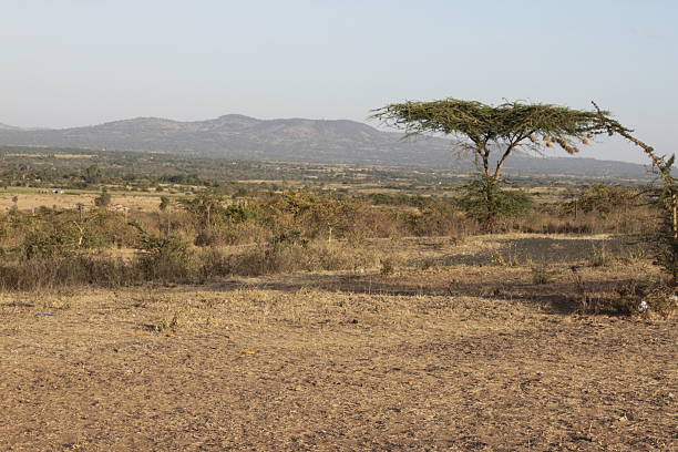
Mount Longonot Crater Hike: A Half-Day Climb From Naivasha
Mount Longonot Crater Hike in Kenya is one of the most exciting outdoor adventures in the Great Rift Valley, offering travellers spectacular volcanic scenery, challenging hiking trails and panoramic views of Lake Naivasha. Located southeast of Naivasha, Mount Longonot rises to approximately 2,776 metres above sea level.
Unlike wildlife safaris, where visitors mainly explore national parks in vehicles, Mount Longonot offers a rewarding walking experience through dry woodland, volcanic slopes and rugged crater ridges.
The hike is particularly popular among travellers staying in Naivasha or visiting Hell’s Gate National Park. Reaching the crater rim is possible within a half-day excursion, while completing the entire circular route requires additional time and greater fitness.
For adventurous visitors exploring Kenya, Mount Longonot provides a memorable combination of exercise, geological discoveries and beautiful Rift Valley landscapes.
Where Is Mount Longonot Located?
Mount Longonot lies within Mount Longonot National Park in Nakuru County, approximately 20 kilometres southeast of Naivasha town.
The mountain forms part of Kenya’s volcanic Great Rift Valley landscape.
It is accessible from Nairobi, Naivasha and other Rift Valley destinations.
Quick Facts About Mount Longonot
| Feature | Description |
|---|---|
| Country | Kenya |
| County | Nakuru |
| Nearest town | Naivasha |
| Mountain elevation | 2,776 metres |
| Mountain type | Stratovolcano |
| National park | Mount Longonot National Park |
| Distance to crater rim | Approximately 3.1 km |
| Full crater circuit | Approximately 13.5 km return |
| Hiking difficulty | Moderate to challenging |
| Recommended duration | 3–6 hours, depending on route |
Why Is Mount Longonot Special?
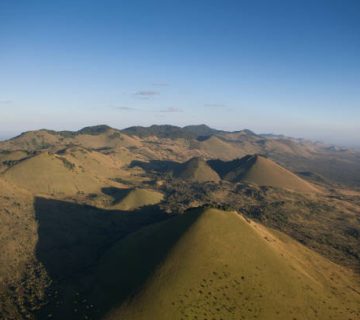
Mount Longonot is famous for its enormous volcanic crater surrounded by steep ridges.
The crater contains a remarkable forest growing within its sheltered interior.
From the rim, visitors can enjoy extensive views across Lake Naivasha and the surrounding Rift Valley.
The mountain’s rugged terrain creates an adventurous experience without requiring specialist climbing equipment on the established route.
However, some sections are steep, loose and physically demanding.
How Was Mount Longonot Formed?
Mount Longonot developed through volcanic activity associated with the formation of the East African Rift.
Over time, eruptions and geological processes created the mountain’s distinctive volcanic structure.
Its broad crater and steep slopes reveal the effects of ancient volcanic activity.
Is Mount Longonot Still Active?
Mount Longonot is considered a potentially active volcano.
Its most recent known eruption is commonly estimated to have occurred during the nineteenth century.
Although the mountain is not currently erupting, its volcanic history remains important to geologists.
Visitors should follow established routes and official park guidance.
Understanding the Hiking Route
The main trail begins at the Kenya Wildlife Service park entrance.
Hikers follow an ascending path towards the crater rim.
The first section passes through dry vegetation before becoming steeper and rockier.
Main Hiking Sections
| Route section | Approximate distance |
|---|---|
| Park gate to crater rim | 3.1 km |
| Complete crater rim circuit | 7.2 km |
| Crater rim to park gate | 3.1 km |
| Total full hiking circuit | 13.5 km |
Visitors can return after reaching the rim or continue around the crater.
Hiking From the Gate to the Crater Rim
The first part of the journey follows a relatively gentle path through scattered vegetation.
As hikers approach the mountain, the trail begins climbing more steeply.
Loose volcanic soil and exposed rocks make some sections challenging.
How Long Does the Ascent Take?
The climb usually takes approximately one to two hours, depending on fitness and weather.
Hikers should maintain a comfortable pace.
Short breaks provide opportunities to enjoy the surrounding landscape.
The final approach can be particularly demanding because of its steep gradient.
Reaching the Crater Rim
Arriving at the crater rim is the highlight for many visitors.
The enormous volcanic depression opens beneath the surrounding ridge.
Dense vegetation covers much of the crater floor.
What Can You See?
Visitors can enjoy views towards Lake Naivasha, the Rift Valley escarpments and neighbouring hills.
On clear days, the scenery stretches across a remarkable landscape of lakes, farmland and volcanic formations.
Photography opportunities are excellent.
However, visitors should remain away from unstable edges.
Walking Around the Entire Crater
Experienced hikers may continue around the complete crater rim.
The circular trail measures approximately 7.2 kilometres.
It follows uneven ridges with repeated climbs and descents.
Is the Full Circuit Difficult?
The complete rim walk is considerably more demanding than simply reaching the first viewpoint.
Some sections are narrow, rocky and exposed.
The circuit generally requires an additional two to three hours.
Visitors should only attempt it when they have sufficient fitness, water and daylight.
Reaching Mount Longonot’s Highest Point
The mountain’s highest point stands at approximately 2,776 metres.
Reaching it requires following the crater rim towards the elevated summit section.
What Makes the Summit Rewarding?
The summit offers impressive panoramic views.
Visitors can appreciate the enormous crater and surrounding Rift Valley from different perspectives.
However, reaching the highest point is optional.
Travellers with limited time can enjoy excellent scenery from the first crater viewpoint.
How Difficult Is Mount Longonot?
Mount Longonot is generally suitable for reasonably fit hikers.
However, the steep volcanic slopes demand physical effort.
The main challenges include loose gravel, exposed sunshine and limited shade.
Main Hiking Challenges
Steep uphill walking.
Loose volcanic stones.
Uneven crater ridges.
Strong sunshine.
Limited water availability.
Slippery paths after rainfall.
Physical fatigue during descent.
Good footwear and adequate hydration are essential.
Wildlife Around Mount Longonot
The surrounding national park supports several wildlife species.
Visitors may encounter zebras, giraffes, gazelles and other animals in suitable habitats.
Wildlife Viewing Opportunities
| Wildlife | Possible habitat |
|---|---|
| Plains zebra | Open grassland |
| Giraffe | Woodland and open areas |
| Buffalo | Grassland and bush |
| Thomson’s gazelle | Open plains |
| Warthog | Grassland |
| Various birds | Woodland and rocky slopes |
Wildlife sightings are unpredictable.
Hikers should maintain safe distances and avoid approaching animals.
Birdwatching on the Mountain
Mount Longonot supports birds associated with dry woodland, open grassland and rocky habitats.
Visitors may observe raptors soaring above the ridges.
Smaller birds move through shrubs along the lower trails.
Birdwatching Tips
Carry binoculars.
Pause periodically to listen for calls.
Avoid disturbing nesting birds.
Early morning generally provides comfortable conditions for birdwatching.
Best Time to Hike Mount Longonot
Mount Longonot can be visited throughout the year.
However, relatively dry months are generally more comfortable for hiking.
January to March and June to September are often favourable.
Seasonal Hiking Conditions
| Period | General conditions |
|---|---|
| January–March | Often warm and relatively dry |
| April–May | Increased rainfall |
| June–September | Generally favourable hiking weather |
| October–December | Variable rainfall |
Heavy rain can make volcanic slopes slippery.
Why Start Early?
Starting early helps visitors avoid the strongest midday sunshine.
Morning temperatures are generally more comfortable.
Cloud cover may develop later, reducing visibility.
Recommended Starting Time
Mount Longonot National Park generally opens at 6:00 am.
Arriving between 6:30 am and 8:00 am is convenient for many hikers.
Those planning the full crater circuit should allow sufficient time to return before the park closes at 6:00 pm.
What to Pack for the Hike
Mount Longonot has limited shade and no reliable drinking water along the main route.
Visitors should arrive prepared.
Essential Hiking Equipment
Hiking shoes with good grip.
At least two litres of drinking water per person.
Sun hat and sunscreen.
Lightweight clothing.
Rain jacket.
Energy snacks.
Small backpack.
Personal medication.
Fully charged phone.
Camera.
Hiking poles can help on steep descents.
Mount Longonot Entrance Fees
Kenya Wildlife Service publishes different entrance fees according to nationality and residency.
Published 2026 Park Fees
| Visitor category | Adult fee |
|---|---|
| East African citizen | KES 500 |
| Kenya resident | KES 675 |
| African citizen outside East Africa | USD 20 |
| International non-resident | USD 50 |
Children qualify for reduced rates.
Guiding and transport charges are separate.
Confirm current fees before travelling.
Do You Need a Local Guide?
Experienced hikers may be able to follow the marked route independently, subject to park instructions.
However, a local guide is recommended.
Guides understand the terrain and can help visitors choose a suitable hiking distance.
They also provide information about geology, wildlife and the surrounding Rift Valley.
How to Reach Mount Longonot From Naivasha
Mount Longonot is accessible by road from Naivasha.
The journey generally takes approximately 30–45 minutes, depending on the starting location.
A private vehicle or organised transfer is convenient.
Travellers arriving from Nairobi should allow additional travelling time.
Suggested Half-Day Mount Longonot Itinerary
Early Morning: Leave Naivasha
Depart your accommodation after an early breakfast.
Travel towards Mount Longonot National Park.
Complete registration and prepare for the hike.
Morning: Climb to the Crater Rim
Begin walking along the established trail.
Take short breaks during the ascent.
Reach the crater rim and enjoy panoramic views.
Late Morning: Return to the Gate
Spend time photographing the crater.
Descend carefully along the same route.
Return to Naivasha for lunch.
Travellers attempting the full rim circuit should treat it as a longer excursion.
Combining Mount Longonot With Lake Naivasha
Lake Naivasha provides a relaxing contrast to Mount Longonot’s demanding slopes.
Visitors can arrange a guided boat excursion to observe waterbirds and hippopotamuses.
Other nearby attractions include Hell’s Gate National Park and suitable lakeside restaurants.
A relaxed afternoon is particularly enjoyable after the morning hike.
Responsible Hiking at Mount Longonot
Mount Longonot is a protected national park.
Visitors should remain on established trails.
Avoid littering or removing volcanic rocks.
Do not disturb wildlife.
Keep a safe distance from crater edges.
Carry reusable water bottles and follow Kenya Wildlife Service regulations.
Why Mount Longonot Is Worth Hiking
Mount Longonot offers one of Kenya’s most memorable volcanic hiking experiences.
Its steep trails, forested crater and panoramic Rift Valley views reward travellers willing to undertake a challenging climb.
The mountain is particularly convenient for visitors staying around Naivasha.
Whether choosing a half-day ascent to the crater rim or completing the longer circular route, hikers can enjoy an exciting combination of geological scenery, physical adventure and natural beauty.



No comment