
Rwenzori Kilembe Trail: A Quieter Alternative to the Central Circuit
The Rwenzori Kilembe Trail is one of Uganda’s most rewarding mountain trekking routes, offering a scenic alternative to the better-established Central Circuit. Beginning near Kilembe in Kasese District, the trail passes through tropical forests, bamboo vegetation, waterfalls, alpine valleys and rugged mountain landscapes.
Located within Rwenzori Mountains National Park, the Kilembe Trail provides access to some of the mountain range’s remarkable scenery. Experienced trekkers can also use the route to approach Margherita Peak, Uganda’s highest point at approximately 5,109 metres above sea level.
For travellers who prefer quieter mountain environments, the Kilembe Trail may be appealing. However, visitor numbers vary, and the route is physically demanding. Proper preparation, experienced guides and sufficient time for acclimatisation are essential.
Where Is the Rwenzori Kilembe Trail?
The Kilembe Trail begins near the former copper-mining town of Kilembe, outside Kasese in western Uganda.
The trail approaches the Rwenzori Mountains from the southern side.
Its lower sections pass through forested slopes before ascending towards the mountain’s high-altitude vegetation zones.
Getting to Kilembe
| Starting point | Approximate driving time | Travel information |
|---|---|---|
| Kasese town | 20–40 minutes | Short road transfer |
| Fort Portal | 1.5–2.5 hours | Via Kasese |
| Queen Elizabeth National Park | 1–2 hours | Depends on starting location |
| Kampala | 6–8 hours | Long road journey |
| Entebbe | 7–9 hours | Allow for traffic |
Travel times depend on road conditions and your exact departure point.
Most trekkers spend a night near Kasese before beginning their hike.
Understanding the Rwenzori Mountains
The Rwenzori Mountains lie along the border between Uganda and the Democratic Republic of Congo.
They contain some of Africa’s highest peaks.
The range is known for its unusual high-altitude vegetation, including giant lobelias and groundsels.
Its landscapes include forests, valleys, rocky slopes, bogs and glaciers.
Major Rwenzori Peaks
| Mountain | Approximate elevation |
|---|---|
| Mount Stanley | 5,109 metres |
| Mount Speke | 4,890 metres |
| Mount Baker | 4,844 metres |
| Mount Emin | 4,798 metres |
| Mount Gessi | 4,715 metres |
Reaching the higher summits requires substantial physical preparation.
Some routes involve technical mountaineering rather than ordinary hiking.
What Makes the Kilembe Trail Different?
The Kilembe Trail is also known as the Southern Circuit.
It was developed as an alternative approach to the Rwenzori Mountains and has been operated by Rwenzori Trekking Services since 2009.
The route passes through several vegetation zones and offers access to high-altitude camps.
Main Attractions
The trail is known for:
Forested mountain slopes.
Waterfalls and rivers.
Bamboo vegetation.
Giant heather and alpine plants.
High-altitude wetlands.
Rocky mountain passes.
Views towards major Rwenzori peaks.
The changing landscape is one of its main attractions.
Kilembe Trail Versus the Central Circuit
The Central Circuit is the older and more established trekking route in the Rwenzori Mountains.
It traditionally begins near Nyakalengija.
Both routes provide access to the mountain’s high-altitude environments.
Comparing the Two Routes
| Feature | Kilembe Trail | Central Circuit |
|---|---|---|
| Starting point | Kilembe | Nyakalengija |
| Approach | Southern Rwenzori | Eastern Rwenzori |
| Main operator | Rwenzori Trekking Services | Rwenzori Mountaineering Services |
| Typical summit duration | Around 8–9 days | Around 7–9 days |
| Accommodation | Mountain camps | Mountain huts |
| Scenery | Forests, valleys and alpine terrain | Valleys, lakes and alpine terrain |
| Difficulty | Very demanding | Very demanding |
| Margherita Peak option | Available | Available |
Neither route should be considered easy.
The best choice depends on your experience, interests and available time.
Is the Kilembe Trail Really Quieter?
The Kilembe Trail is often promoted as a quieter alternative to the Central Circuit.
Its southern approach and distinct camp network can provide a different trekking experience.
However, the number of hikers changes according to season and bookings.
You should not assume that the trail will be empty.
If avoiding large groups is important, ask your operator about expected departures during your travel dates.
A private trekking arrangement may provide greater flexibility, subject to park requirements.
Main Camps Along the Kilembe Trail
The route includes several established mountain camps.
The exact overnight stops depend on the itinerary.
Common Kilembe Trail Camps
| Camp | Approximate elevation | Main characteristics |
|---|---|---|
| Sine Camp | 2,600 metres | Forest environment |
| Kalalama Camp | 3,134 metres | Higher mountain vegetation |
| Mutinda Camp | 3,588 metres | Alpine scenery |
| Bugata Camp | 4,100 metres | High-altitude landscape |
| Hunwick’s Camp | Around 4,000 metres | Mountain views |
| Margherita Camp | Around 4,485 metres | Summit preparation |
Elevations vary slightly between published route descriptions.
Operators may adjust overnight stops to suit the programme.
What to Expect During the First Days
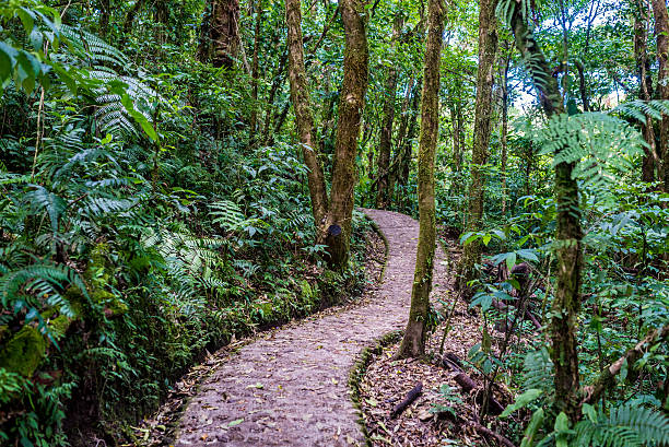
The lower sections of the Kilembe Trail pass through montane forest.
You may encounter tall trees, dense vegetation and flowing streams.
As the trail climbs, the landscape gradually changes.
Forest Trekking
The first day introduces trekkers to steep paths and humid forest conditions.
You may hear birds and other forest wildlife.
The ground can be slippery, particularly after rainfall.
Bamboo and Heather Zones
Higher sections include bamboo and heather vegetation.
The air becomes cooler as elevation increases.
Trekkers also begin to notice the physical effects of climbing.
The Alpine Landscape Around Mutinda
Mutinda Camp is an important stop on several Kilembe itineraries.
The surrounding terrain includes unusual alpine plants and mountain valleys.
Some programmes include an optional walk towards Mutinda Lookout.
This can provide additional high-altitude experience.
However, side trips should be considered alongside your acclimatisation needs and physical condition.
Your guide will advise whether the additional activity is appropriate.
Trekking Towards Bugata and Hunwick’s Camp
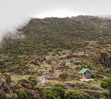
The higher sections become more exposed.
Trekkers may cross wet ground, rocky paths and steep slopes.
Weather can change quickly.
Boggy Conditions
The Rwenzori Mountains receive substantial rainfall.
Some sections are muddy or waterlogged.
Waterproof boots and suitable clothing are important.
Trekking poles may help with balance.
Mountain Passes
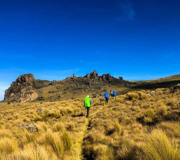
Higher passes provide views across mountain valleys when weather conditions are clear.
However, fog and cloud can limit visibility.
Your guide will determine whether conditions permit safe progress.
Climbing Margherita Peak From Kilembe
Margherita Peak is the highest point in the Rwenzori Mountains.
It stands on Mount Stanley at approximately 5,109 metres.
Reaching the summit is a serious mountaineering undertaking.
Technical Climbing Requirements
The summit approach may involve steep rock, ice and glacier terrain.
Depending on current conditions, equipment can include:
Climbing harness.
Helmet.
Crampons.
Ice axe.
Ropes.
Suitable mountaineering boots.
Glacier conditions change over time.
Your operator must assess the route and provide appropriately qualified mountain guides.
A successful summit is never guaranteed.
How Difficult Is the Kilembe Trail?
The Kilembe Trail is a demanding mountain trek.
Even without attempting Margherita Peak, the route involves substantial elevation gain and difficult terrain.
Main Challenges
| Challenge | What to expect |
|---|---|
| Altitude | Reduced oxygen availability |
| Rainfall | Wet and slippery trails |
| Mud | Slow progress |
| Temperature | Cold conditions at higher elevations |
| Long walking days | Physical fatigue |
| Summit terrain | Technical mountaineering |
Previous hiking experience is strongly recommended for longer itineraries.
Altitude Planning and Acclimatisation
Altitude is one of the most important considerations when trekking in the Rwenzori Mountains.
As elevation increases, the amount of oxygen available decreases.
Some people develop altitude illness.
Symptoms can include headache, nausea, dizziness and unusual fatigue.
Severe altitude illness can become life-threatening.
Reducing Altitude Risks
Choose an itinerary that allows appropriate acclimatisation.
Avoid rushing towards high camps.
Inform your guide immediately if symptoms develop.
Do not continue ascending with worsening symptoms.
Descending may be necessary.
Consult a qualified healthcare professional before travelling if you have relevant medical conditions.
Best Time to Trek the Kilembe Trail
Rwenzori trekking is possible during different periods of the year.
However, rainfall can make conditions more challenging.
Seasonal Conditions
| Period | General conditions | Trekking considerations |
|---|---|---|
| December–February | Often relatively drier | Popular trekking period |
| March–May | Common rainy season | Wet, muddy trails |
| June–August | Often relatively drier | Suitable for trekking |
| September–November | Common rainy season | Increased rainfall |
Rain can occur throughout the year.
High-altitude weather remains unpredictable.
What to Pack for the Kilembe Trail
Packing should reflect the route’s wet conditions and changing temperatures.
Essential Equipment
| Item | Purpose |
|---|---|
| Waterproof hiking boots | Protect feet on wet trails |
| Rain jacket | Protection from rainfall |
| Warm fleece | Insulation |
| Thermal clothing | Cold-weather comfort |
| Waterproof trousers | Wet-weather protection |
| Gloves | Warmth |
| Trekking poles | Balance on uneven terrain |
| Headtorch | Early starts |
| Sleeping bag | Mountain camp accommodation |
| Water bottle | Hydration |
Technical summit equipment should be arranged with your operator.
Accommodation on the Kilembe Trail
Trekkers stay in designated mountain camps.
These are basic facilities rather than luxury accommodation.
Sleeping arrangements depend on the camp.
Meals are generally prepared by the trekking support team.
Porters help transport supplies and equipment.
You should confirm sleeping arrangements, toilet facilities and equipment requirements before booking.
How Much Does the Kilembe Trail Cost?
Trekking costs vary according to duration, group size and summit objectives.
A shorter mountain hike generally costs less than a full Margherita Peak expedition.
Main Cost Factors
| Cost component | What it covers |
|---|---|
| Park fees | Protected-area access |
| Mountain guides | Trekking supervision |
| Porters | Equipment transport |
| Camp accommodation | Overnight facilities |
| Meals | Food during the trek |
| Technical equipment | Summit requirements |
| Transport | Transfers to the trailhead |
Request a complete quotation showing all inclusions and exclusions.
Combining Kilembe With a Uganda Safari
The Rwenzori Mountains are located near several other western Uganda attractions.
Travellers can combine trekking with visits to Queen Elizabeth National Park or Fort Portal.
However, a demanding mountain expedition should include sufficient recovery time.
Avoid scheduling strenuous activities immediately after a challenging summit attempt.
The Rwenzori Kilembe Trail provides a scenic southern approach to Uganda’s famous mountain range.
Its forests, waterfalls, alpine valleys and mountain camps offer a rewarding experience for well-prepared trekkers.
Although it may feel quieter than the Central Circuit, both routes require serious physical preparation and experienced guides.
For travellers interested in challenging mountain adventures, the Kilembe Trail is an excellent option when planned with realistic expectations and appropriate safety arrangements.


No comment